Map Gallery
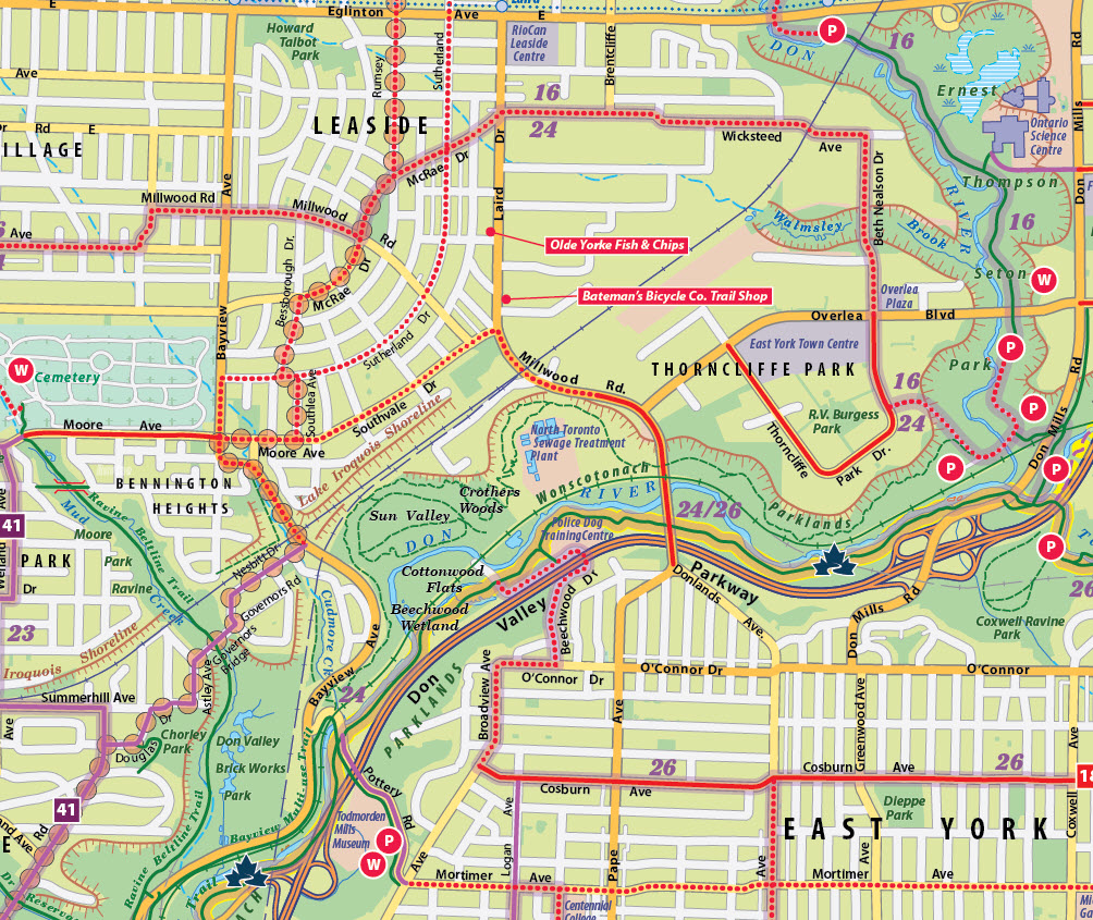

Toronto Trails
For a Toronto publishing company, we're creating a series of detailed multi-use trail maps for different cities. Here's a close-up of part of the Toronto map.

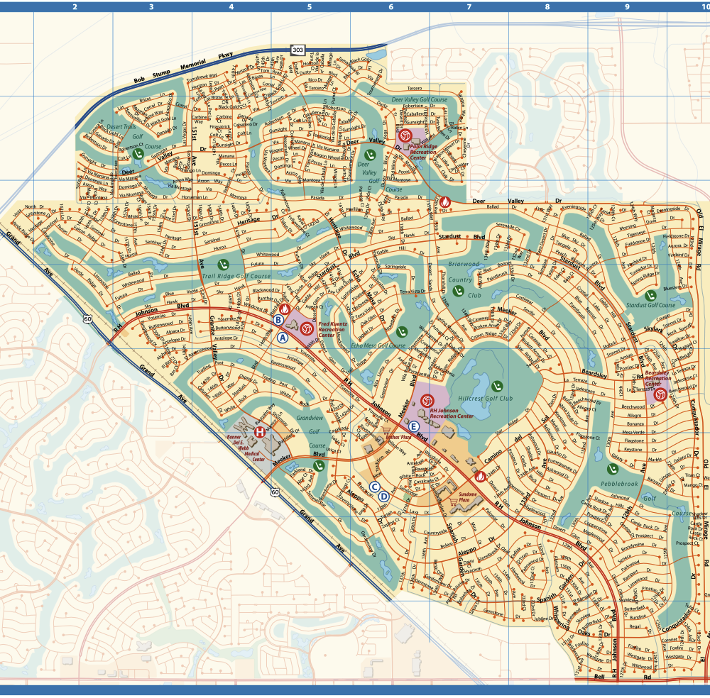
Sun City West
This is a detailed street map of a city in Arizona. Bright, sunny colors
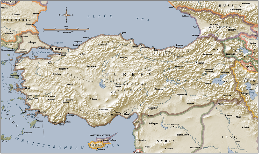
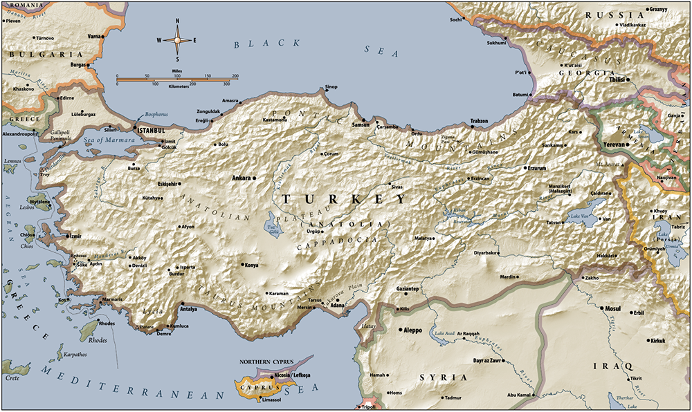
Turkey
We created a series of full color maps for a book set in the Turkey area. As often happens, we worked with the graphic designer of the book to ensure that the colors and typefaces conformed to the general look and feel of the book itself.

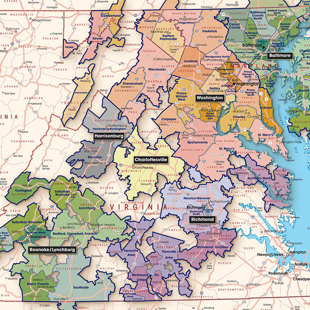
Comcast DC
This is a regional view of Comcast's designated marketing areas. We visually grouped the marketing areas (identified by the black labels) into similarly colored clusters of zones, so that the extent of neighboring market areas could be as clear as possible.
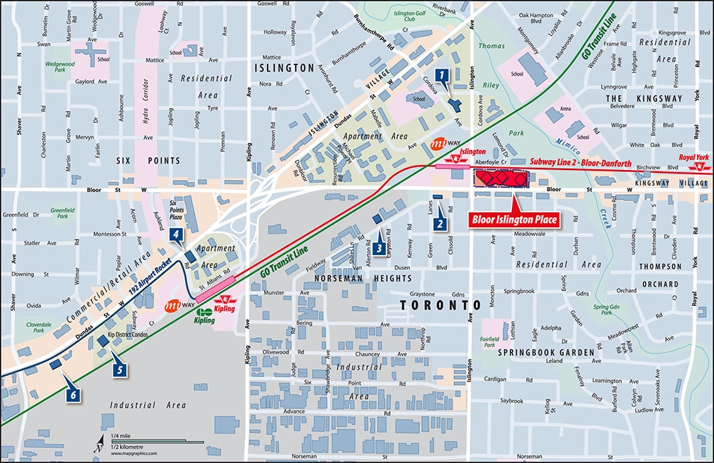

Toronto West
A commercial real estate client asked us for an easy-to-read half-page size map showing the subject property in the context of the public transit lines, as well as competing properties for sale in the area. The background colors refer to various kinds of land use: commercial/retail, industrial, institutional, and residential. The economic "character" of the general area can be seen at a glance.
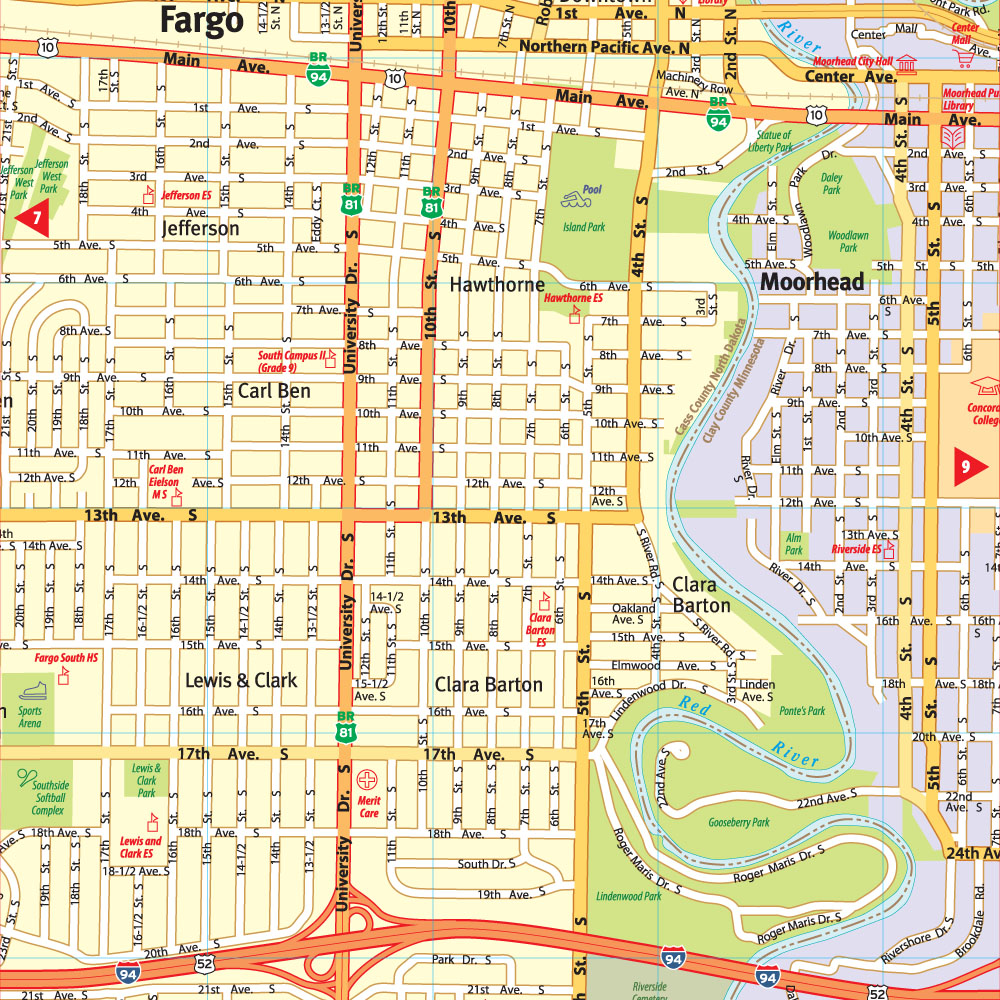

Fargo Ambulance
For years, The F-M Ambulance Service in Fargo-Moorhead has relied on our Street Atlas to respond to emergencies. Not Google Maps. Map Graphics maps!
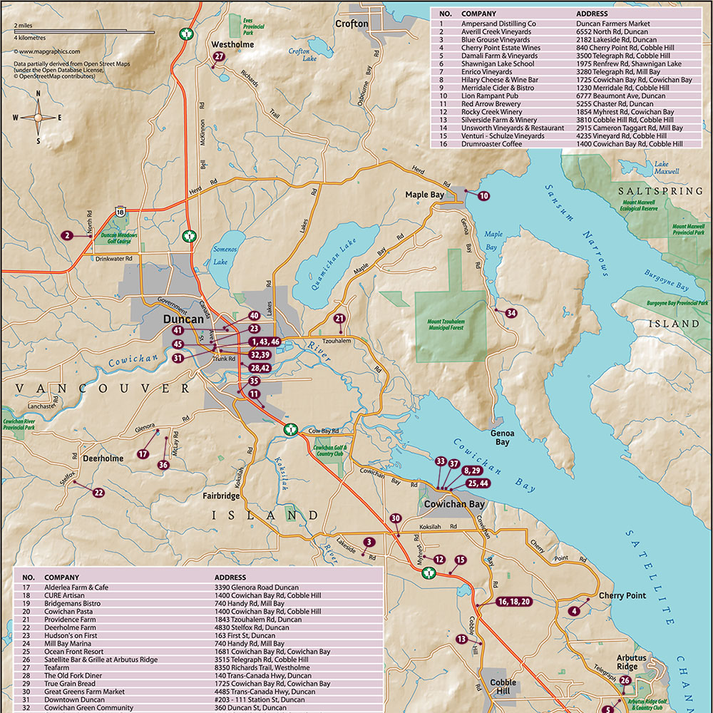

Vancouver Island
The Savour Cowichan Festival on Vancouver Island asked us to prepare this colorful map showing the locations of their advertisers.

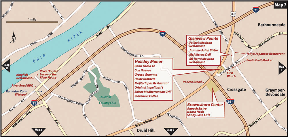
Louisville Dining
For more than 20 years, Louisville Dining magazine has had us keep detailed maps of the locations of restaurants up-to-date. There are 16 pages of these maps in each edition.
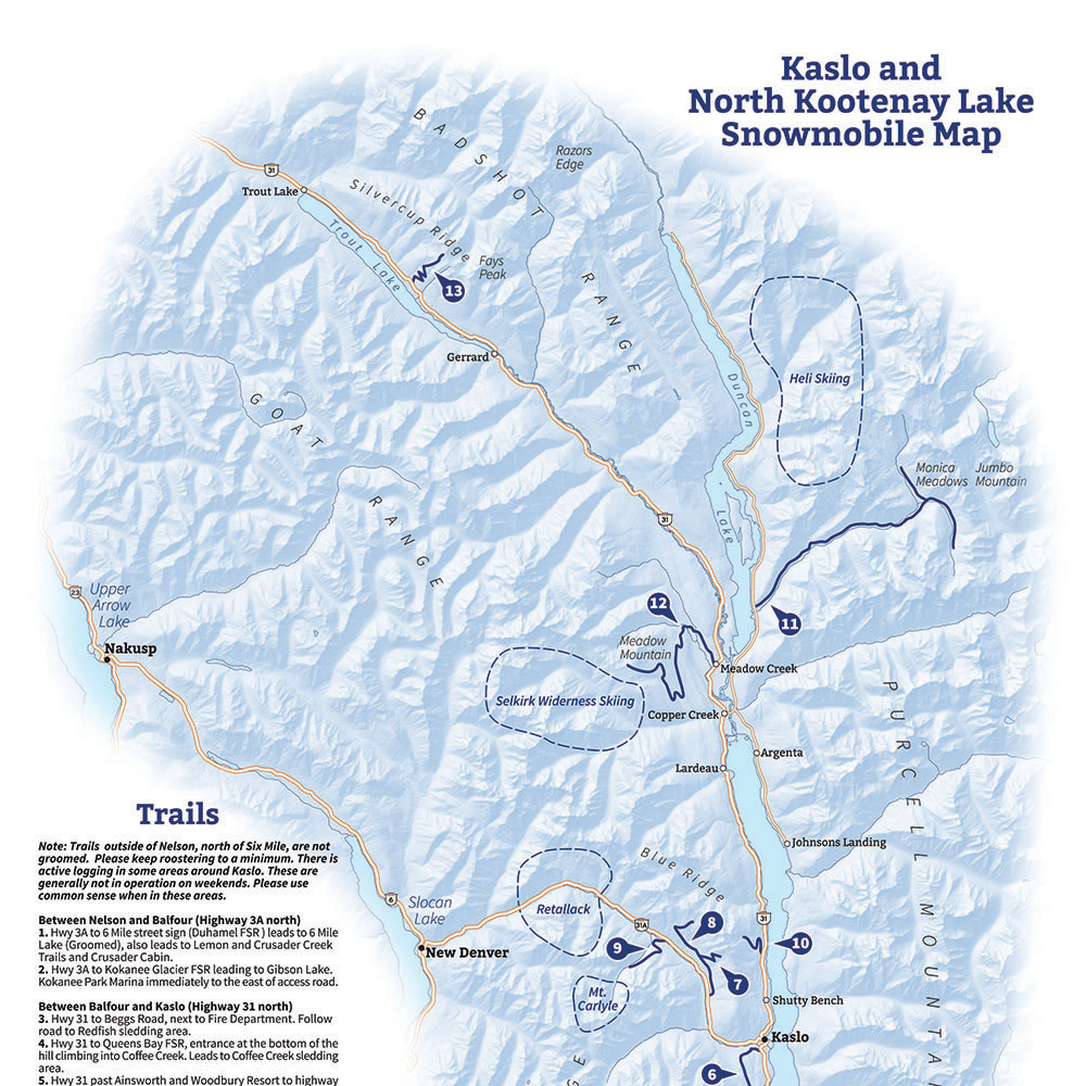

Kaslo, BC
This is part of a Snowmobile Trails map we created for Kaslo Tourism.
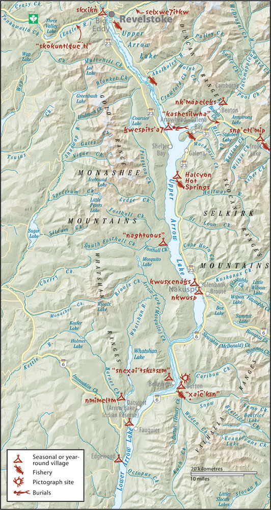
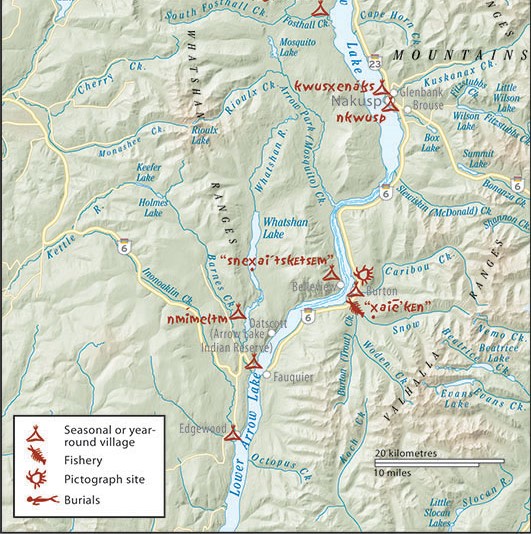
Indigenous People
For a book about the history of the Sinixt People of southern British Columbia and northern Washington, we created a series of detailed maps showing their villages, fisheries, and pictographs.
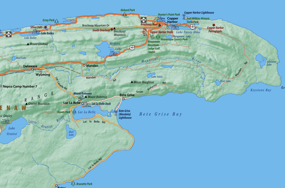

Keweenaw Peninsula
A map publisher in Michigan had us produce a detailed tourism map called Keweenaw Adventure Map, showing the many attractions in the area. This is a close-up look at a small section of the map.

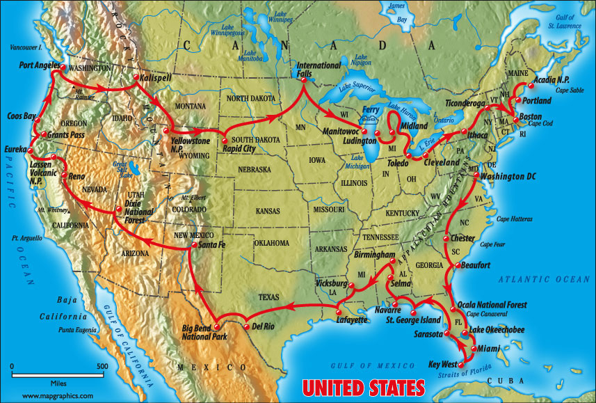
USA Route Ruthbatik.com
This is a map done for an author Ruth Batik on her cross country tour

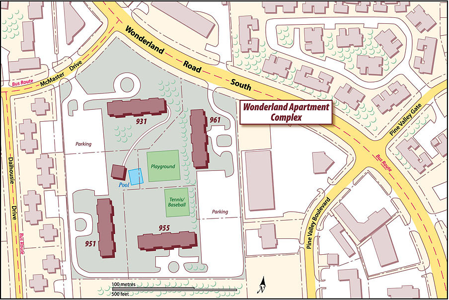
Wonderland Complex
An investment banker regularly calls on us to create attractive maps illustrating real estate investment proerties. This is a closeup view of one such property, called a site plan.
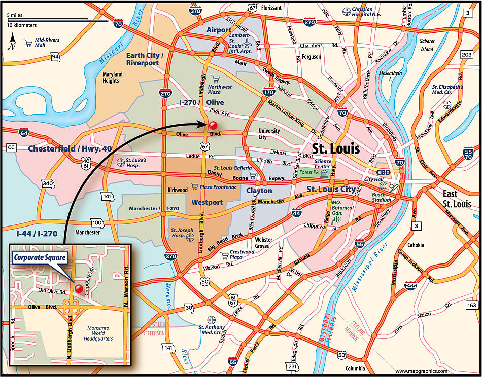

St. Louis
An investment management company in Germany asked us to prepare a number of real estate submarket maps for their informational brochures. Here's a low-resolution version of one of them.

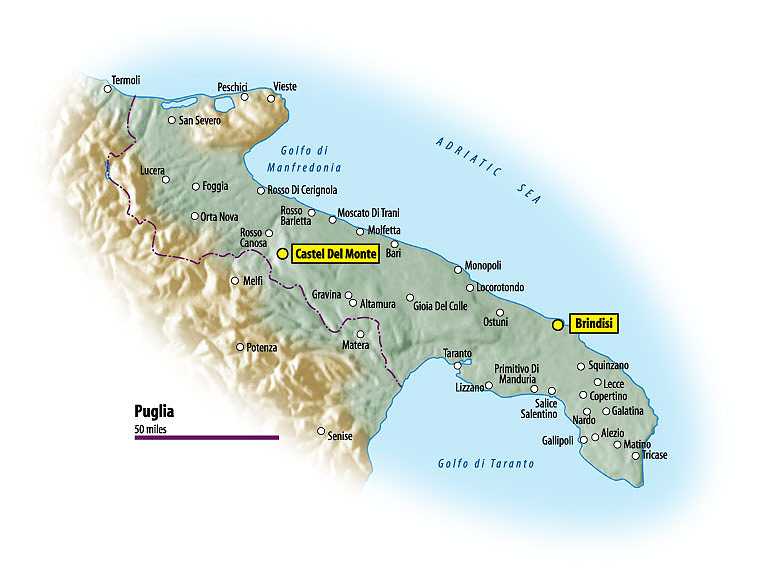
Puglia
We're often asked to create maps of wine-producing areas. Here's one showing Puglia -- that's the heel of Italy's boot. It's for a brochure promoting the two locations highlighted on this map
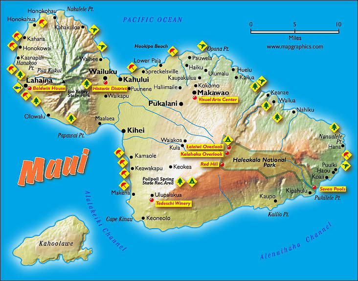

Maui
This map of Maui was one of a series of maps we created for a website which rents out accommodations to vacationers.

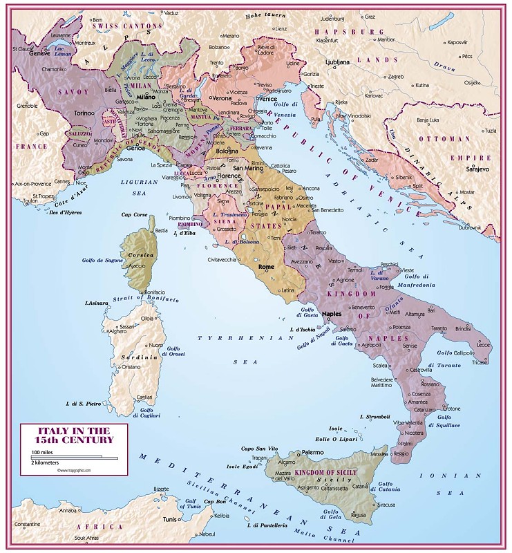
Italy
This is a history-book map illustrating the mosaic of states within Italy in the 15th century..

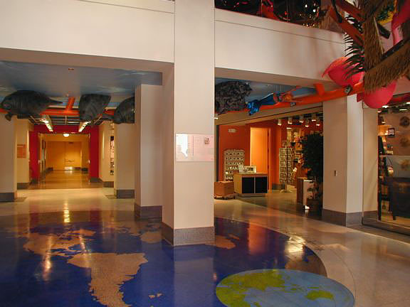
Floor Painting
We did this map of the world on an azimuthal projection centered on Orlando, Florida. It's been built into the floor of the Orange County Regional History Center in Orland
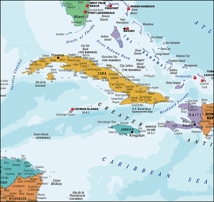

Caribbean
What you see here is a small portion of a wall map of the Caribbean that we custom made for a shipping company. The company now has full rights to this map